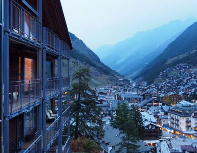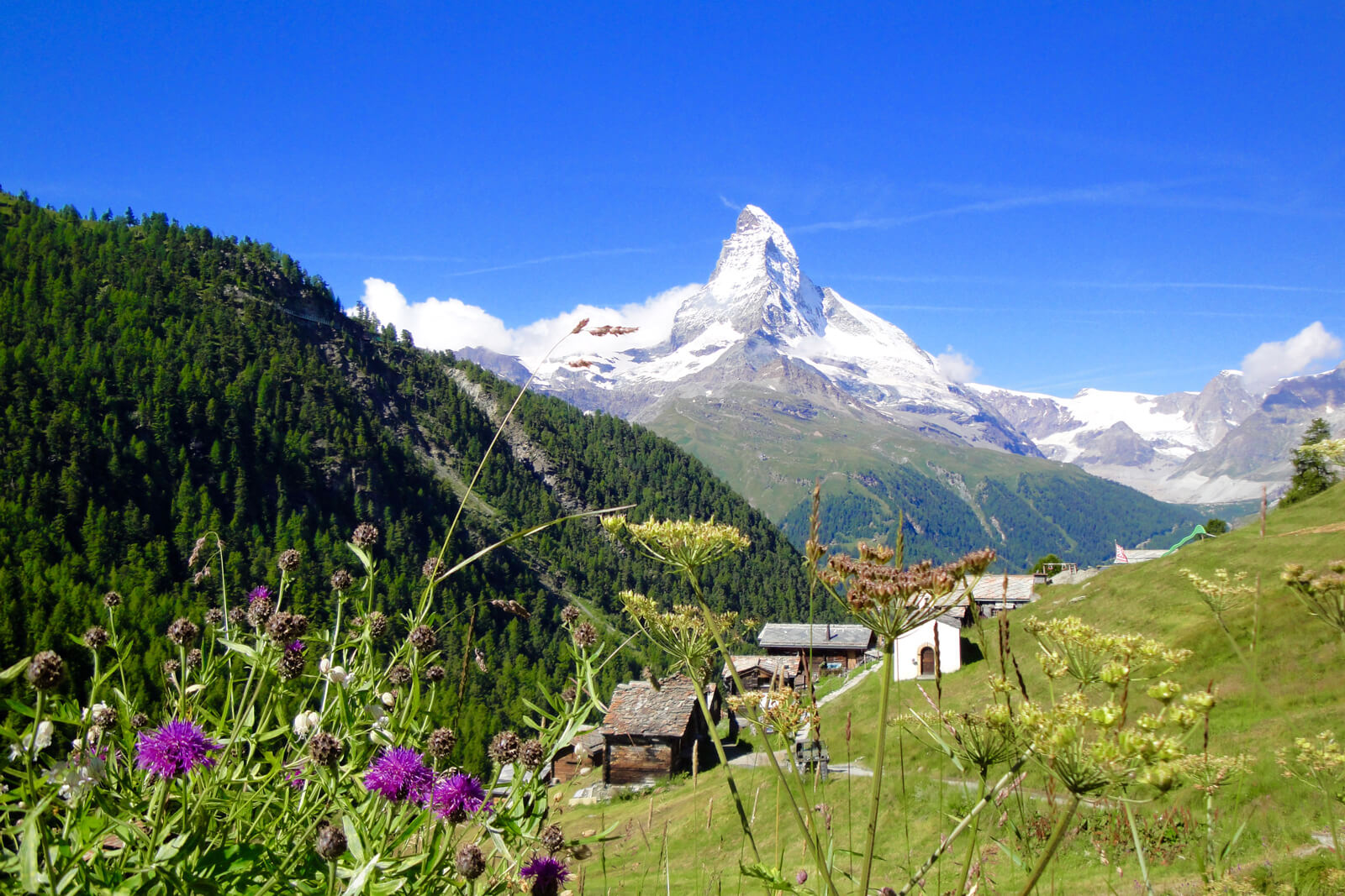
The mountain that guards the neat Swiss village of Zermatt is hardly a well kept secret.
Anybody who has ever flirted with the idea of a hiking holiday, thumbed through the glossy travel supplement of a weekend newspaper or paused to study the packaging before stuffing triangles of Toblerone into their mouths, will surely know its name.
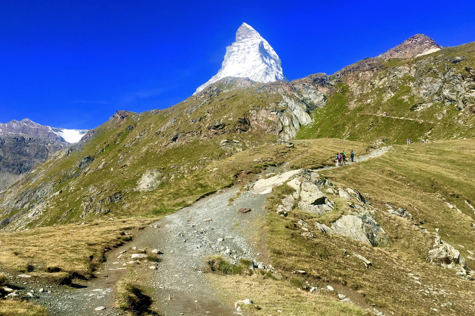
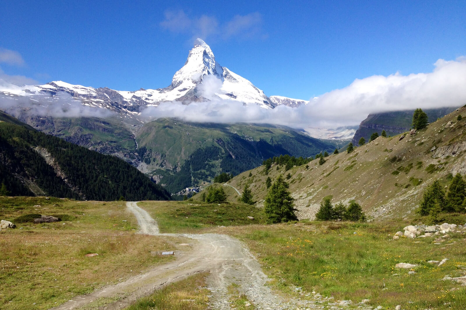
This iconic peak is the Matterhorn - an immediately recognizable, perfect pyramidal lump of granite that holds claim to the title "world's most photographed mountain."
At 4478 meters, the Matterhorn - or Cervino as it is known across the border in Italy - is not the tallest of the thirty-eight snow-tipped giants that line the rim of this alpine bowl. But it is undeniably the most beautiful, the most enigmatic and the most unforgettable.
Indeed, once you have seen the Matterhorn up close and have been seduced by its subtle charms, the magnetism of the mountain will pull you back again and again...
Zermatt is a paradise for hikers of all levels.
The views from the village hardly compare to the vistas that greet you when you hike up into the mountains. Above the rooftops and stilted wooden chalets of Zermatt, nearly 400 kilometers of well-marked and maintained hiking trails unfold.
There is a trail for everyone who wants to try hiking in Zermatt: from an easy "walk in the woods" to scenic long-distance hikes above the tree-line, glacier treks and ascents to some truly remarkable summits. Many of the trails are punctuated at intervals by mountain restaurants serving everything from simple sustenance to exquisite gastronomic delights.
Most routes are enriched by a flurry of fragrant flora and local wildlife. All provide a number of picture-perfect spots ready for that Matterhorn selfie.
Such is the range and diversity of hiking trails in Zermatt, it would be impossible to do it justice in a short post. So below are three of my favorite Zermatt hikes with lots of details. I picked them based on their ease of navigation, their accessibility and most significantly, their unrivalled views of the majestic Matterhorn.
Hike 1: Rotenboden to Riffelberg
- Trail length: 2.7 kilometres
- Grade: easy
- Estimated time: 40 minutes
- Starting point: Gornergratbahn Zermatt - Rotenboden, various tickets available from CHF 102 return (50% discount GA, Half-fare, Swiss Travel Pass)
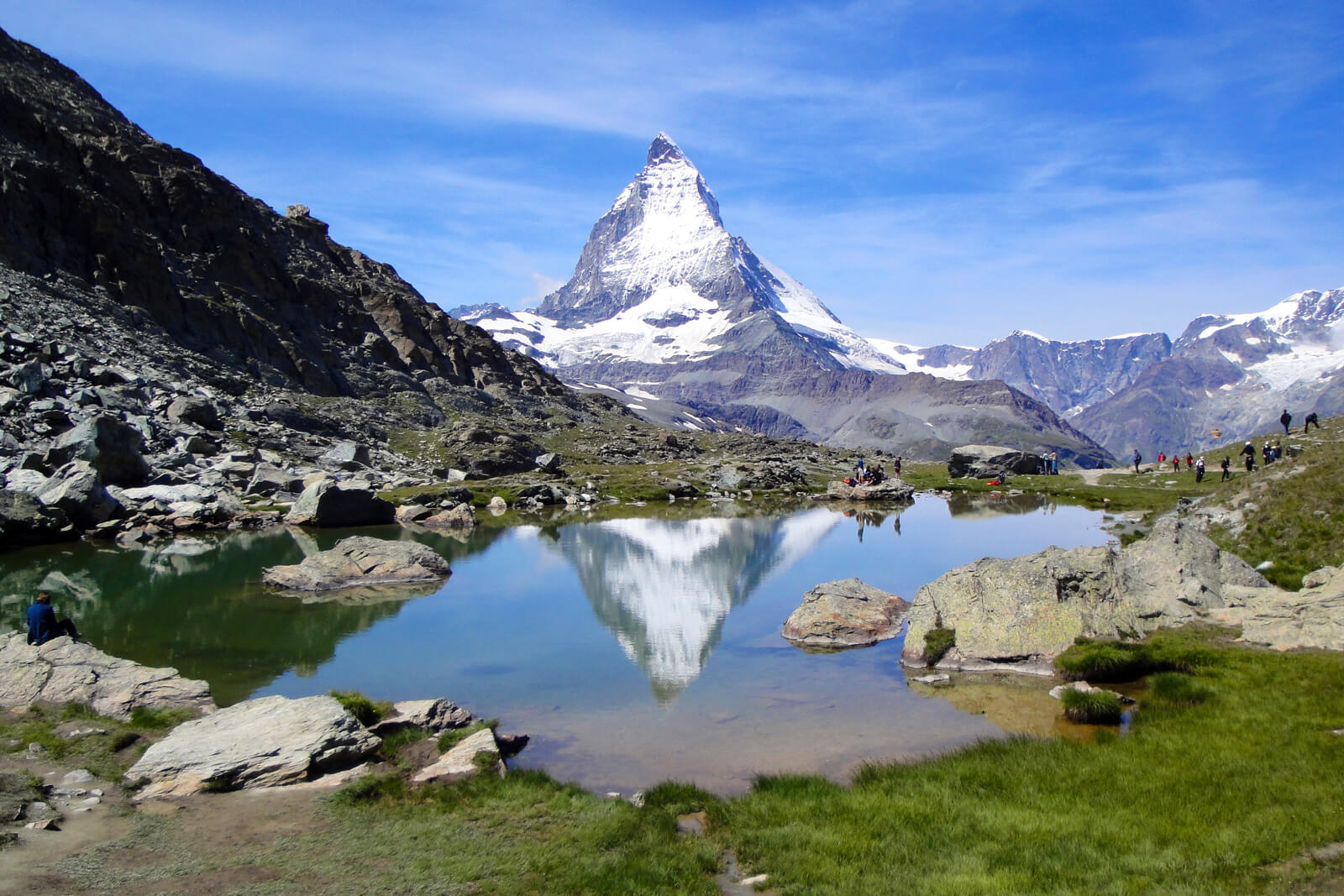
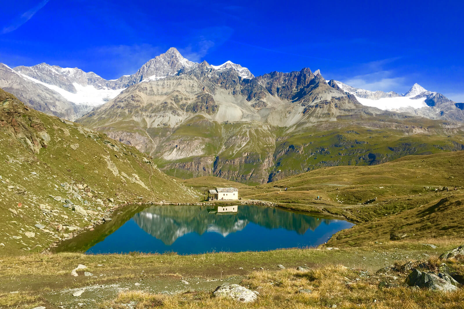
This brief, mostly downhill trail starts at the Rotenboden station at 2815 m. This is the penultimate stop on the Gornergratbahn from Zermatt, or the first if descending from the summit. Dropping down from the station, a short, steepish descent leads to the breathtaking beauty of the Riffelsee. On still days, the crystal clear waters offer up amazing reflections of the Matterhorn.
The trail takes you along the right bank of the lake on a sandy path with occasional rocky protrusions. It proceeds to pass a smaller, shallower water pool, then snakes gently downwards towards Riffelberg.
The Matterhorn is omnipresent and at its most photogenic. In splendid isolation and seemingly within touching distance, the perpetual photo-stops to marvel at its magnificence are likely to add some time to the route...
Following the signs for Riffelberg, the path continues along a regularly marked dirt track, passing the unique Bruder Klaus chapel on the left before arriving at the station (2582 meters).
From here, take the Gornergratbahn back to Zermatt or continue down a steeper, more challenging route to Riffelalp where the five-star splendor of the Riffelalp Resort awaits. Note that this hike can also be taken in winter and in reverse, allowing a little extra time for the ascent.
Hike 2: Zermatt to Sunnegga via Findeln
- Trail length: 6 kilometres
- Grade: moderate
- Estimated time: 2 hours
- Starting point: trail starts in the center of Zermatt
From the village center (1672 meters), head towards the charming suburb of Winkelmatten from where signs for Findeln and Sunnegga lead to a series of moderate switchbacks through the forest. Gradients advance and abate in yo-yo fashion, but every little bit of elevation reaps rich rewards. Each turn offers up a new reveal, a fresh mountain vista, an unmissable photo opportunity.
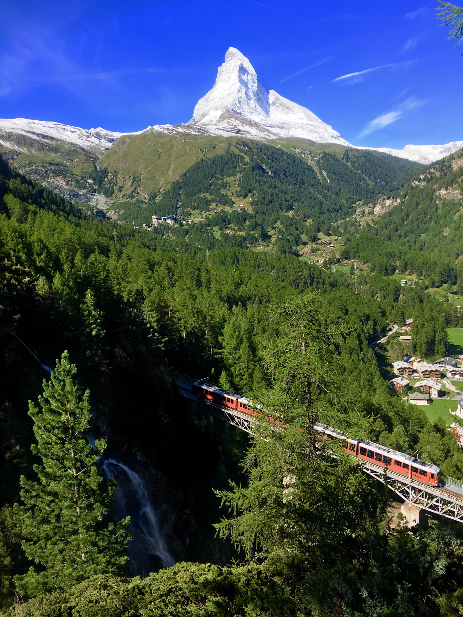
After half an hour or so under canopy, you emerge from the woods directly above Findelbach. It is worth taking a breather on one of the benches here and waiting for the Gornergratbahn to pass over the metal bridge below on its way to/from the summit.
The train, the waterfall and the Matterhorn as a backdrop make up a striking scene well worth witnessing... Be warned, though: the small, unmarked yet enticing "path" towards the precipice makes for a precarious perch!
Energies restored, continue on the gravel path which climbs steadily along the cliff edge towards Findeln. The trail is marked at intervals with inviting benches to take a rest and absorb the incredible views. And the inevitable glances back over your shoulder to check whether the Matterhorn is still there will undoubtedly add to the journey.
The quaint hamlet of Findeln is foodie heaven with restaurants Chez Vrony, Findlerhof and Enzian, all worth a lunch stop. Fresh gourmet menus, unbeatable mountain views and stellar reputations mean that depending on the season, time of day and size of the party, it is advisable to book ahead of time.
Leaving Findeln behind, the broad trail - steep and rocky in sections, winds upwards in a series of loops. At Sunnegga, you can continue by cable car to Blauherd (Stellisee) and Rothorn, or return to the village either on foot or via the Sunnegga Express funicular.
Hike 3: Schwarzsee to Hörnlihütte (and back!)
- Trail length: 8.5 kilometres
- Grade: difficult
- Estimated time: 4.5 hours round trip
- Starting point: Matterhorn Paradise gondola Zermatt - Schwarzsee CHF 55 return (50% discount GA, Half-fare, Swiss Travel Pass)
Beginning at the Schwarzsee gondola station (2552 meters), this roughly two and a half hour ascent to the recently refurbished Matterhorn base camp is not for the faint-hearted or those with a fear of heights.
At a high altitude, exposed to the elements, and nerve-wrenchingly narrow in parts, the path is nonetheless popular. During high season, it attracts a large number of hikers/climbers and is prone to overcrowding.
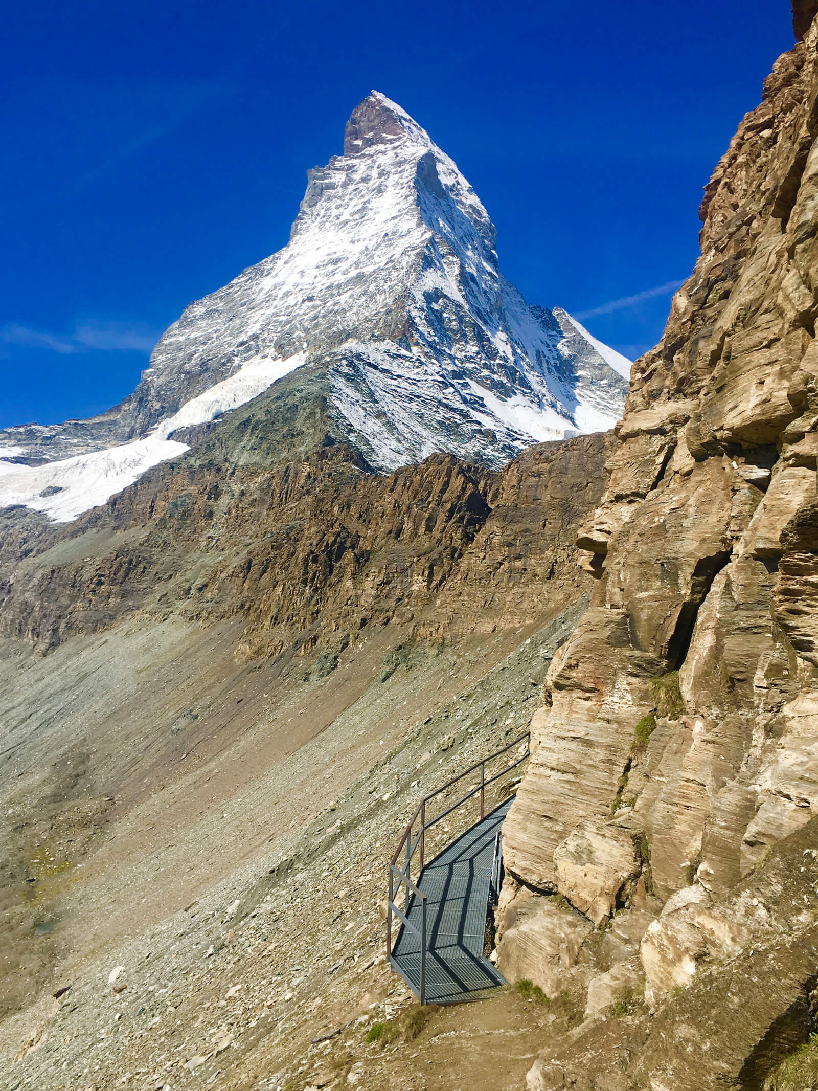
To access the trail, follow the signs for Hirli, Hörnlihutte or Trockener Steg from where the broad track arches above and to the left of the Schwarzsee (black lake) and the pretty chapel Maria zum Schnee (Our Lady of the Snow). Then, climb the neat switchbacks of the grassy mound that sits in front of the mountain’s northeast ridge.
Briefly erased from view as you scale the steep hillside, the Matterhorn re-emerges at around 1.5 kilometers as the rocky meadows give way to a layered lunar landscape of underfoot scree and a wind-weathered cliff face.
As a result of erosion to this part of the path, a brief section of metal staircases and cantilevered walkways have been screwed into the rock face for a safe passage. Then follows a series of fairly steep switchbacks up to the top of the Hirli, and a gradually ascending stretch in front of the mountain before the real work begins...
The last section of the Hörnliweg ascends three hundred meters in less than 1.5 kilometers. Remember, this is at an altitude where oxygen levels are noticeably lower than down in the village of Zermatt. The gradient is steep, the trail narrow and rocky, and the consequences of a slip or fall could be fatal. Fixed ropes are in place for safety on particularly difficult sections but sure-footedness and a head for heights are essential.
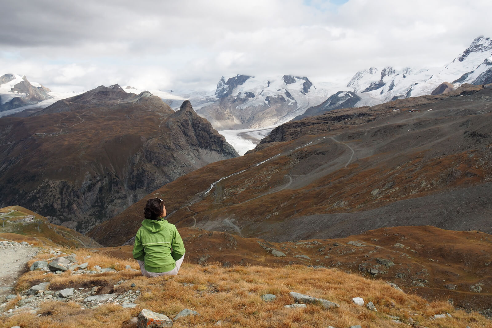
On arrival at the hut, you can marvel at the Matterhorn up close, as well as take in a breathtaking alpine panorama that includes Breithorn, Weisshorn, Monte Rosa and the Matterhorn Glacier. Having studied the mountain from a distance at every angle imaginable, to stand directly beneath it is a humbling experience.
It is worth noting that the descent, while (obviously) quicker than the climb - can pose difficulties if you are rushed. The Hörnlihütte hike should not be attempted in adverse weather conditions when snow or ice on the paths can make them particularly treacherous. Similarly, if conditions change suddenly as they are prone to do in the mountains - if the cloud thickens such that visibility is compromised, one should descend immediately.
To minimize the chances of this, choose a clear day and make an early start from the Schwarzsee. The visual reward at 3260 meters is a world away from the chocolate shops and high-end boutiques in the village below.
While hiking in Zermatt, it is nature in all her magnificent glory that reigns supreme.